Update on the Redwood Fire – ignitions planned beginning Wednesday, 9/13
Contact: Rebecca Paterson, Fire Communication and Education Specialist
Email: seki_fire_info@nps.gov
SEQUOIA AND KINGS CANYON NATIONAL PARKS, Calif., 9 September 2023 –
Good afternoon neighbors,
We have an update on the Redwood Fire, to help with awareness and planning.
To review: The Redwood Fire was ignited by lightning and discovered on August 15. This fire is located in the wilderness of Sequoia National Park, up the Middle Fork drainage, about 11 air miles from park headquarters. This fire currently poses no risk to life or property.
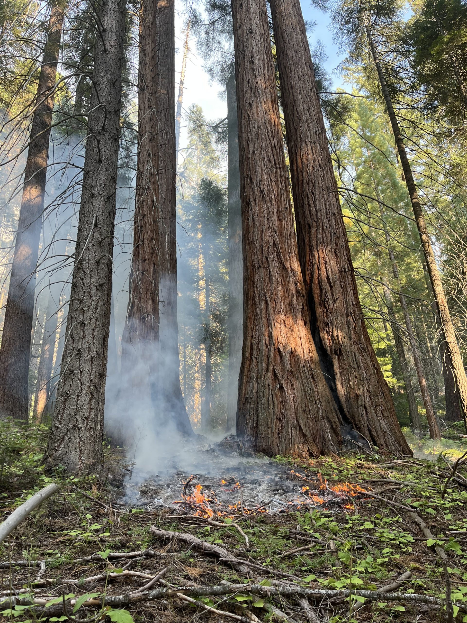
The Redwood Fire was most recently mapped by fixed wing aircraft on 09/06, at 299 acres. Fire managers are implementing a confine and contain strategy to ultimately suppress this fire. Preexisting natural and manmade barriers including Cliff Creek, Granite Creek, Paradise Ridge Trail, and Cliff Creek Trail have been identified as viable containment features, with a high probability of successfully holding the fire. Crews have spent the last several shifts securing the fire edge along portions of the Granite Creek Trail, and have improved portions of the Cliff Creek Trail and Paradise Ridge Trail for containment lines.
The next step towards containment is to initiate low-intensity backing fire above the proposed containment features, and slowly bring fire down the hill. By doing so, firefighters will be able to regulate the intensity of the fire as fuels are consumed. Regulating the intensity of the fire will help to ensure that there are favorable fire effects within the burned area, especially as the fire moves through giant sequoia groves. A combination of aerial firing and hand firing is planned. These ignition operations will increase the size of the fire to about 1,500 acres.
Ignition operations are planned to begin on Wednesday 09/13 and continue for about 7 days. While ignition operations are being conducted, there may be a noticeable increase in smoke production. Smoke impacts in the Middle Fork drainage (e.g., Giant Forest, the foothills, and Three Rivers) are expected to be the most pronounced late at night and in the morning, as downslope winds carry the smoke down canyon. Smoke impacts will generally improve in late morning/early afternoon, as diurnal up canyon winds carry smoke up and out of the Middle Fork drainage.
Especially during ignitions, the Redwood Fire will be highly visible from Moro Rock as well as other high vantage points in Sequoia popular with visitors (Lakes Trail, Alta Trail, Etc.). We recommend https://fire.airnow.gov/ to keep abreast of local particulate matter readings and smoke dispersion patterns. For regular updates on the fire, maps, photos, etc, visit https://inciweb.wildfire.gov/incident-information/caknp-redwood-fire.
Please feel free to reach out with questions.
[SOURCE: Sequoia and Kings Canyon National Parks]