Sheriff Places Two Zones in Lower Mineral King Road and Salt Creek Areas on Evacuation Warning
NOTE FROM THREE RIVERS TOGETHER: This information may duplicate messages you have already received. We have been asked to send it to you to ensure that as many people of the community receive it as possible.
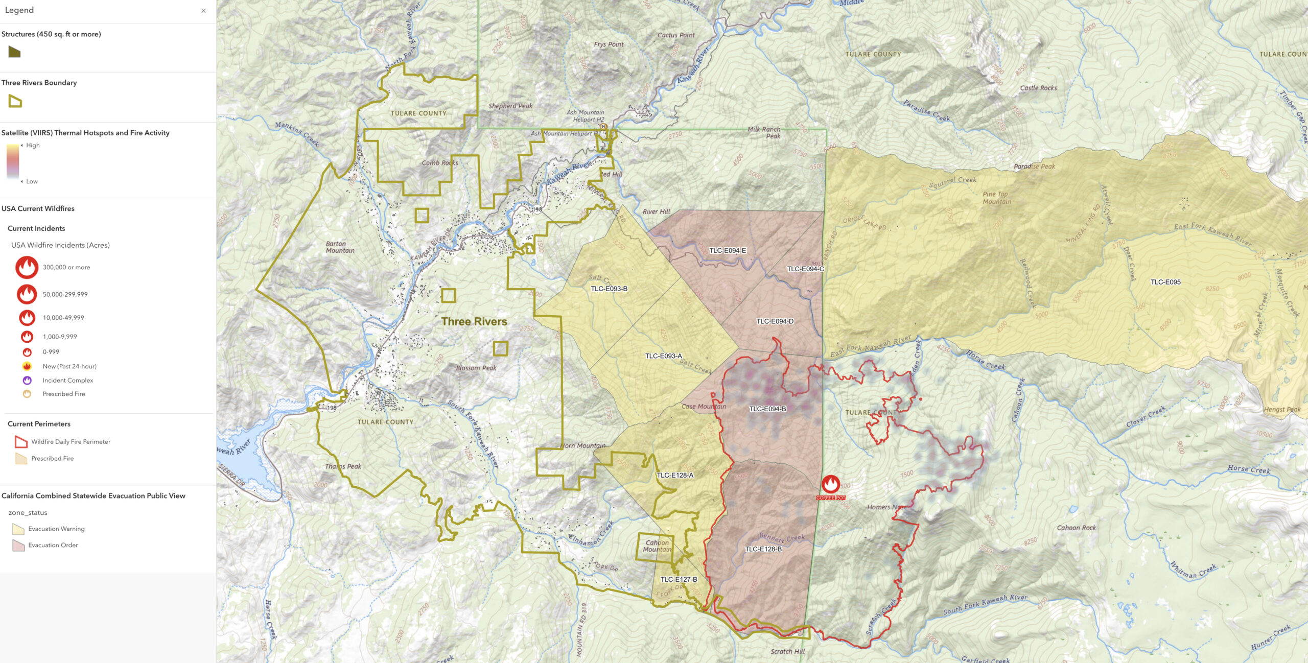
Sheriff Boudreaux has issued two new Evacuation Warnings due to current fire conditions for zones TLC-E093-A and TLC-E093-B. At this time, no official zone descriptions have been provided; however, Zone TLC-E093-B includes a portion of the Mineral King Road below the Oak Grove Bridge and includes a section of the Salt Creek watershed. Zone TLC-E093-A lies on the northwestern flank of Case Mountain and includes the upper portion of the Salt Creek watershed. Please refer to the Genasys or Watch Duty websites and the map below for a graphical zone and area depiction.
An Evacuation WARNING means, you should prepare to evacuate the area should fire approach your home or if ordered to do so. Please stay clear and out of area impacted by the fire.
For additional fire and closure information, please call the Incident Public Information office at 559-492-9988 or refer to https://inciweb.wildfire.gov/incident-information/caknp-coffee-pot-fire.
[NOTE: The image below is from Three Rivers Together. The Fire Activity is NOT live, and depicts previous satellite data.]